
Statistics Canada
www.statcan.gc.ca
Common menu bar links
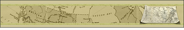
List of maps
Archived Content
Information identified as archived is provided for reference, research or recordkeeping purposes. It is not subject to the Government of Canada Web Standards and has not been altered or updated since it was archived. Please contact us to request a format other than those available.
1868 to 1915 Canada Year Book – Related maps
- 1867-Dominion of Canada, showing the Railways and their principal connections
- 1870-Dominion of Canada, showing the Railways and their principal connections
- 1871-Railway map of the Dominion of Canada
- 1872-Dominion of Canada, distances between Europe and America
- 1874-Canada and part of the United States
- 1875-Canada and part of the United States
- 1879-Canada showing distances and relation to continents of Europe and America
- 1895-British possessions and principal commercial routes
- 1901-Dominion of Canada
- 1915-Precipitation during
April to August
1877 Canada Year Book – Related maps
1917 Canada Year Book – Related maps
1927 Canada Year Book – Related maps
- Canada showing normal mean temperature and precipitation January, 1927
- Canada showing normal mean temperature and precipitation July, 1927
- Geology of eastern Canada and Newfoundland, 1927
- Dominion of Canada, 1927
- Geology of western Canada, 1927
- Growth of water power development in Canada, 1927
- Map of the Dominion of Canada, showing forest regions, 1927
- Map of the Dominion of Canada, showing main types of farming, 1927
- Map of the Dominion of Canada, showing principal mineral resources and value of output by products and provinces, 1927
- Movement of Canadian wheat crops in bushels, 1927
- Natural resources of Canada, 1927
- Orography of eastern Canada and Labrador, 1927
- Orography of western Canada, 1927
1937 Canada Year Book – Related maps
- Canada water powers, 1937
- Dominion of Canada, 1937
- Map of the Dominion of Canada showing forest regions, 1937
- Map of the Dominion of Canada showing the main types of farming, 1937
- Mineral production and occurences, 1937
- Movement of Canadian wheat crop, 1937
- Orographical map of the
Dominion of Canada (exclusive of northern regions)
and Labrador - Value of mineral production by provinces, 1936
1947 Canada Year Book – Related maps
- Dominion of Canada, 1947
- Geology of Canada, 1947
- Orographical map of Canada (exclusive of northern regions) and Labrador, 1947
- Plan showing the extent of the continental shelf off the Pacific Coast of Canada, 1947
1957 Canada Year Book – Related maps
- Distribution of population, Canada, 1957
- International geophysical year, 1957
- Physiographic regions of Canada, 1957
- Scheduled air services in and beyond Canada, November, 1957
1967 Canada Year Book – Related maps
- Aeromagnetic compilation of northern Alberta (Thompson and Churchill), 1967
- Canada's position in the Northern Hemisphere, 1967
- Map of Canada, 1967
- Main geological regions of Canada, 1967
- Mineral references in Newfoundland, 1967
- Mineral references in Ontario, 1967
- Mineral references in Quebec, 1967
- Mineral references in the Maritime provinces, 1967
- Mineral references in the Prairie provinces, 1967
- Standard time zones of Canada, 1967